- Geothermal case study
De-risking geothermal exploration
The UK lags several other European countries, including the Netherlands and Iceland, in the use of clean and sustainable geothermal energy, but this must change if the UK is to meet its future carbon targets.
One of the major barriers for take up of the technology is the risk of failure, given the very high costs involved in drilling wells. For example, in 2014, a 2 km-deep well drilled in the Northeast of England achieved sufficient thermal gradient but failed to flow water to the surface at viable rates due to the complex nature of the rock layers that make up the subsurface geology.
This is where expertise at the University of Leeds could make a difference, helping to de-risk exploitation of primary onshore and offshore sites with potential for UK deep geothermal, notably the deep subsurface of the Cheshire Basin, the East Irish Sea Basin and the North Sea Basin.
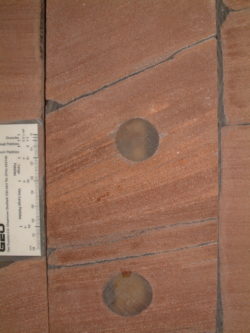
Core from Permian Auk Formation, Central North Sea.
Geothermal potential
The Cheshire Basin comprises a sedimentary rock succession of Triassic and Permian conglomerate, sandstone, siltstone and mudstone units up to 6 km thick. The sandstone-dominated parts of the succession, in particular, act as deep aquifers: layers of sedimentary rock that contain and transmit groundwater.
“For deep aquifers to act as potential sources of geothermal energy, sedimentary rocks with appropriate porosity and permeability distributions at depths are required, such that the natural heat flow in the earth’s subsurface allows water present in pore spaces within the rock to be heated to temperatures suitable for the production of hot water back to the surface via wells,” says the research team in the Sedimentology Group of the School of Earth and Environment, who have spent many years studying the characteristics of subsurface reservoir successions, including those of the Cheshire Basin. “Ideally these rock types are present deep in the subsurface adjacent to highly populated urban areas, and so enable hot water to be produced close to where it is needed. The Cheshire Basin meets all these criteria.”
The team has gained insights into the complexity of the rocks in this basin by studying outcrops at the surface, in addition to subsurface cores recovered from deep wells. This approach has provided data from which an improved understanding has been gained of the deeper geology, especially the complex 3D arrangement of different rock layers, some of which readily allow the passage of fluids, whereas others act as barriers to flow.
Reservoir characterisation
Expertise at Leeds in characterising sub-surface reservoirs is applicable to both groundwater and geothermal aquifers. Members of the Sedimentology and Hydrogeology groups at Leeds gather data on the geometry, physical properties, porosity and permeability of surface outcrops of the basin and use these to build 3D models of the likely geological arrangement of rock units with specific porosity-permeability characteristics in the subsurface succession. These models are then used to predict how fluids flow through the subsurface, enabling companies to assess the feasibility of deep geothermal wells. The research team’s particular interest is in sedimentary rocks of aeolian, fluvial and shallow marine origin – those deposited through the action of wind, river or waves.
The Leeds’ researchers have developed a series of relational databases that cover hundreds of outcrop successions all around the world. Companies considering deep geothermal wells in new areas can draw on this wealth of data to more fully understand the properties of the geological successions in question, helping to de-risk projects.
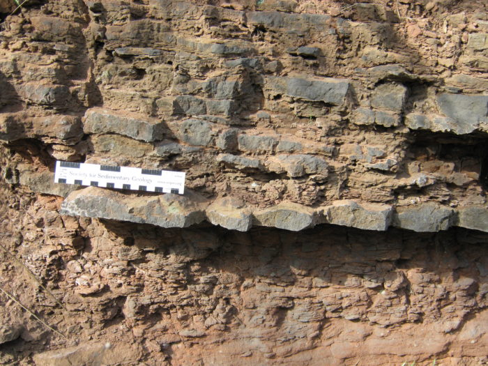
Interbedded thin sandstones and mudstones of fluvial origin, Helsby Formation, Helsby Quarry, Cheshire
Carbon Capture and Storage
Formations such as those present in the Cheshire Basin also offer potential sites for underground storage of carbon dioxide (CO2) in porous and permeable sedimentary rocks. This is another important approach to reducing the UK’s emissions. Traditionally, discussion around carbon capture and storage (CCS) has focused on the re-use of depleted oil and gas fields of the North Sea as the main storage site.
“The long-term storage capacity in depleted oil and gas fields is relatively limited, whereas deep saline reservoirs present in rock formations in the deeper parts of the Cheshire Basin are much larger and require shorter distances for transportation”. Any CCS project will also need the kind of detailed reservoir characterisation that we can provide to prevent damage to the rock adjacent to the well caused by mineralisation of the injected CO2. This then leads to a rapid drop-off in the ability of the well to pump liquid CO2 into the host rock. The key to longevity of sites is to target layers that are especially permeable to enable the liquid CO2 to spread out efficiently from the injection well and minimise the impact of early mineralisation.”
The databases that the Leeds research groups have built over the years are now commercially available. In addition, many companies have worked with the University for many years and have benefited from technical guidance and help with specific issues.
“Having the data is one thing, but you also need the expertise to make sense of it,” explains the research team in the Sedimentology Group. “We understand the value of the data and have the knowhow to apply it as a predictive tool to predict the detailed 3D geology of a broad range of subsurface settings.”